Tuesday, May 07, 2013

The Real Annaly Bay

I discovered recently that the tide pools I visited back in 2008 (see this post) were not in Annaly Bay but in nearby Wills Bay.  (click on photo to enlarge)
I, and others I’ve spoken with, had been under the impression that the Trumbull Trail which begins behind the Carambola Resort, led to Annaly Bay, because when people mention “the tide pools” there is the automatic assumption that tide pools means Annaly Bay.  In fact, I learned that there are a number of tide pools along the northwest corner of St. Croix, with Annaly Bay being the best known.  Since learning about my misconception, I’ve been eager to go see the real Annaly Bay, and when the St. Croix Hiking Association led a hike last month to Annaly Bay, I jumped on the opportunity to go.
We met Olasee Davis, our guide, in Frederiksted and car pooled in pickup trucks up to the top of the ridge overlooking Annaly Bay. A 4-wheel drive vehicle is a must for those who come by car.
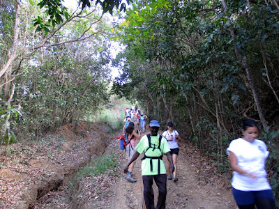
From the top of this ridge at about 700 feet above sea level, we hiked down a steep dirt road into the bay.  This hike is relatively short but the return uphill is strenuous!
Arriving at Annaly Bay we see St. Croix’s north Shore to the East
And the Maroons and Ham’s Bluff to the West.
Hiking around the rocky shoreline is a must to get to the tide pools.
A dip in the natural tide pools makes the effort worthwhile.

Under rough seas, these tide pools have proved treacherous for swimmers.
We had calm waters
And spectacular views.

Labels: , , ,

Monday, April 12, 2010

An Afternoon Hike in Salt River Bay

Sunday afternoon we joined Olasee Davis and the St. Croix Hiking Association on a hike at the Salt River Natural Historical Park and Ecological Preserve.
Salt River Bay has probably seen more action throughout history than all the rest of St. Croix. There's evidence of settlements by the Igneri people during their migration from South America around AD650, and later settlements by the Arawaks, the Taino and the Caribs.

Columbus's men got into a scuffle here with the Kalinago people in 1493. Two men died of their arrow wounds, and so Columbus named the eastern tip, "Cape of the Arrow."

By 1663, Salt River Bay was a European settlement with governmental buildings, parks, and stables. The area later became a sugar plantation, and now it is a park and a preserve.

Join us on this little hike as we take a tour through history:

Piles of stone mark the sites of archeological finds.
This is the view East towards Christiansted
A ship wreck off the Cape of the Arrow.
Grapetree bushes and succulents thrive here.
Including the Aloe, which old-time Crucians used for home remedies.
Lots of coral along the northern shore.

Our guide Olasee demonstrating how his grandmother used this coral as an egg beater.
Facing west Salt River Bay, where the National Oceanographic and Atmospheric Administration (NOAA) has an underwater research lab located near the deep submarine canyon known as "The Wall."
Rounding the corner towards Triton Bay
Hiking along Salt Pond
A mini forest of baby mangroves growing up in Salt Pond.
In the 1960s the area around Salt Pond was dredged and filled. Land developers began construction of this hotel, but it was soon abandoned.
Their dreams of making big money went down with the structure as it began to slowly sink because the fill on which it was built turned out to be unstable.

The place lies derelict while the Park Service decides whether to destroy it or restore it.

Labels: , ,